Why Rwanda is Called the “Land of a Thousand Hills”
Rwanda has earned the nickname “Land of a Thousand Hills” because of its unique and picturesque geography, which is dominated by a vast number of hills, valleys, and mountains. The name reflects the country’s topography, where steep hills and mountainous regions shape much of the landscape. The term comes from the local Kinyarwanda phrase “Igihugu cy’ imisozi igihumbi,” which translates to “the country of a thousand hills.”
Geography and Topography of Rwanda
Rwanda’s terrain is famously hilly and mountainous, a feature that distinguishes it from many other African countries. The central and southern parts of the country are particularly known for their rolling hills, which rise gradually, creating a beautiful patchwork of hills and valleys. These areas are characterized by elevated terrain that offers expansive views across the land.
However, the western part of Rwanda is much more rugged and mountainous, with steep slopes and towering peaks that rise sharply above the surrounding landscape. This western region is home to the Virunga Mountain range, a collection of active and dormant volcanoes that form a natural boundary between Rwanda, Uganda, and the Democratic Republic of Congo.
The Virunga Mountains, located in the northwest of the country, are not just an important geographical feature but also one of the most iconic parts of Rwanda. Mount Karisimbi, the tallest of the Virunga peaks, stands at 4,507 meters (14,783 feet) and is a key part of Rwanda’s dramatic landscape. Alongside Karisimbi, the Virunga Mountains include other notable peaks such as Mount Bisoke and Mount Muhabura. These mountains have a major role in Rwanda’s tourism, as they are home to the endangered mountain gorillas.
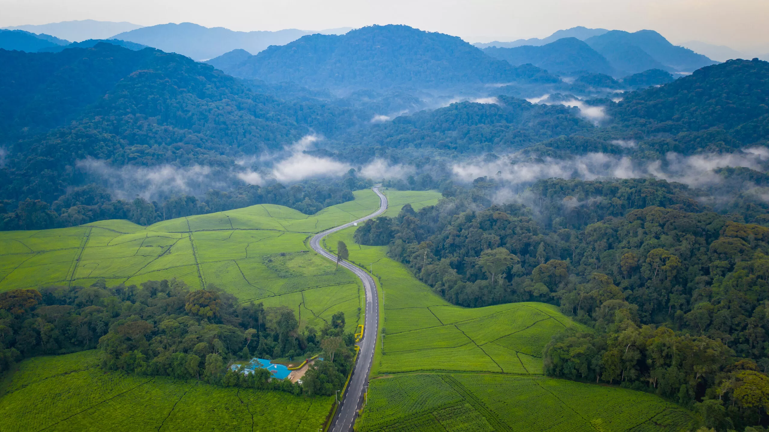
The Congo-Nile Divide
Another significant geographical feature contributing to Rwanda’s hilly terrain is the Congo-Nile Divide, which runs through the western part of the country. This divide is a natural ridge that separates the watersheds of two of Africa’s major river systems—the Nile and the Congo. The divide runs from north to south through Rwanda, creating numerous valleys, hills, and steep slopes along its path. The land on the western side of the divide drains into the Congo River system, while the eastern side drains into the Nile.
This geographical division not only shapes the country’s landscape but also has a profound effect on Rwanda’s hydrology and ecosystems. The steep slopes and rugged terrain along the divide make it one of the most beautiful regions in Rwanda, with lush forests and deep valleys interspersed with high ridges and hills.
Cultural and Historical Significance of Rwanda’s Hills
Rwanda’s hilly geography has greatly influenced its culture, economy, and agricultural practices. Historically, the terrain played a significant role in shaping the way Rwandans lived. The rolling hills and steep slopes meant that much of the population had to adapt by farming on terraced hillsides. This technique was developed to prevent soil erosion and maximize agricultural output on the steep land. Terraces are still used today, particularly in rural areas, to cultivate crops such as maize, beans, and bananas, as well as cash crops like coffee and tea.
The hills also contributed to the formation of distinct communities throughout Rwanda. In the past, these natural boundaries sometimes separated people, giving rise to a unique cultural identity in each region. These communities adapted their way of life to the challenging terrain, which included building homes and villages on elevated land to protect themselves from flooding or other natural disasters.
Environmental Importance of Rwanda’s Hills
Rwanda’s hills are not just beautiful; they are also crucial to the country’s biodiversity. The varied terrain provides a range of habitats for different species of plants and animals, contributing to Rwanda’s status as an ecological hotspot in Africa. The Virunga Mountains, for example, are home to the world’s last remaining population of mountain gorillas. These critically endangered animals thrive in the dense, temperate forests of the highland areas. Rwanda has become a global center for gorilla conservation, and the mountainous regions surrounding Volcanoes National Park are at the heart of these conservation efforts.
The country’s hills are also home to other rich ecosystems, including tropical rainforests, savannahs, and wetlands. Rwanda’s diverse geography supports a wide variety of wildlife, including several species of primates, birds, and other animals, many of which are endemic to the region. The hills provide a sanctuary for these species and play a critical role in maintaining ecological balance.
Tourism and Scenic Beauty
Tourists are drawn to Rwanda not only for its wildlife but also for its breathtaking landscapes. The views from the hills are stunning, offering sweeping vistas of lush valleys, shimmering lakes, and dense forests. One of the major attractions is Lake Kivu, located in the western part of the country. This scenic lake, surrounded by hills and mountains, is a popular destination for visitors looking for both relaxation and adventure.
The hilly terrain also makes Rwanda an ideal location for hiking and adventure tourism. Visitors can explore the volcanic slopes of the Virunga Mountains or take treks through Nyungwe Forest, a mountainous rainforest in the southwest that offers a rich diversity of flora and fauna. Rwanda’s stunning scenery, shaped by its hills, has become a key component of its growing tourism industry.